 Hurricane
Hurricane Danny 2015
![]()
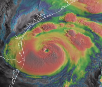
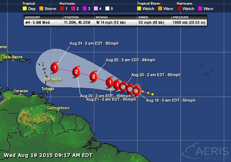
Hurricane Danny finally intensified Thursday morning into the first hurricane of the 2015 Atlantic hurricane season, well to the east of the Lesser Antilles in the central Atlantic Ocean.
Microwave satellite imagery indicates Danny’s convection looks to be more solidly organized around its center of circulation Thursday morning than it was Wednesday, notes hurricane specialist, Michael Lowry.
Danny’s hurricane-force winds extended up to only about 10 miles from the center of circulation as of the 11 a.m. advisory from the National Hurricane Center, a tiny hurricane-force wind field.
Small circulations such as Danny are prone to sudden changes in intensity, which can be difficult to forecast.
Dry air will be a continual challenge to Danny over the next several days, as water vapor imagery indicates an ample reservoir of dry air north of Danny extending westward into the Caribbean Sea.
Dry air hampers tropical cyclones by encouraging the development of stronger thunderstorm downdrafts, which then either squelch nearby thunderstorms from forming or push them away.
This dry air is also stable, meaning it suppresses upward vertical columns of air needed to maintain or form new thunderstorms.
![]()
Wind shear, namely, the change in wind speed with height either in speed and/or direction, can blow convection away from the center from a tropical cyclone. If strong enough, this can rip apart existing tropical cyclones.
Despite what had been a rather hostile atmosphere featuring record mid-July through mid-August Caribbean wind shear, Danny will remain far enough south over the next couple of days to remain in an environment of rather light wind shear.
So, assuming the atmosphere immediately surrounding Danny remains somewhat moist, Danny may remain a hurricane through this weekend.
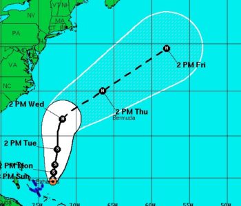
Danny will move generally toward the west-northwest the next several days. Computer model forecast guidance shows that it may not reach the longitude near the eastern Caribbean Sea (about 61 degrees West longitude) until Monday.
As a result, we have plenty of time to monitor its progress.
Given the aforementioned dry air and wind shear in place over the eastern Caribbean Sea, it’s possible that this system will be weakening once it reaches the vicinity of the Lesser Antilles, but may still be at least minimal hurricane strength upon arrival.
It remains too early to get too specific on impacts to those islands. Interests in the Lesser Antilles, the Virgin Islands and Puerto Rico should monitor the progress of Danny.
Stay tuned to The Weather Channel and check back with weather.com for updates on this system.
Incidentally, while small, Danny isn’t the smallest tropical cyclone on record. According to the NOAA’s Hurricane Research Division, Tropical Storm Marco in 2008 had gale-force winds extending only 12 miles from the center. Danny’s tropical storm-force winds extended up to an estimated 60 miles from the center, as of late Thursday morning.
Danny became only the fourth named storm to become a hurricane in the strip of the Atlantic Ocean from off west Africa to the Lesser Antilles since the start of the 2011 season. Gonzalo (2014), Humberto (2013) and Katia (2011) were the only others to do so in that stretch of over four seasons.
![]()