 Florida
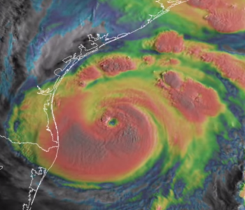
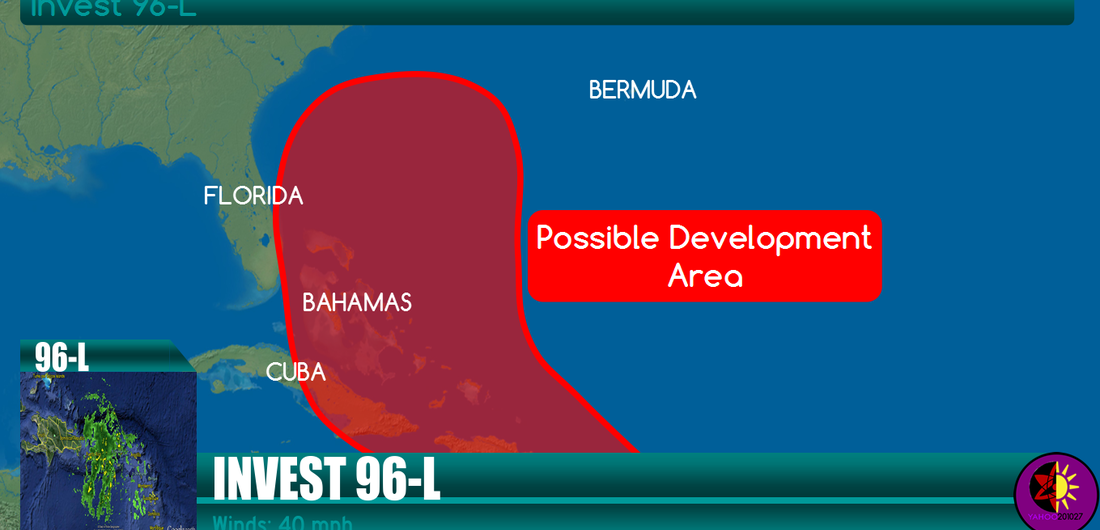
Invest 96L
Shower and thunderstorm activity associated with an elongated area of low pressure located several hundred miles east of the Windward Islands has become a little better organized during the past few hours. Additional slow development of this system is possible during the next day or two, and a tropical depression could form as the system moves west-northwestward at 10 to 15 mph across the Lesser Antilles and into the Caribbean Sea. After that time, land interaction could limit development potential over the weekend. Regardless of tropical cyclone formation, gusty winds and heavy rainfall are possible across portions of the Lesser Antilles, Puerto Rico, and the Virgin Islands on Thursday night and Friday. Interests in those islands should closely monitor the progress of this system. An Air Force Reserve Hurricane Hunter aircraft is scheduled to investigate this system tomorrow afternoon, if necessary. * Formation chance through 48 hours…medium…50 percent. * Formation chance through 5 days…high…60 percent.


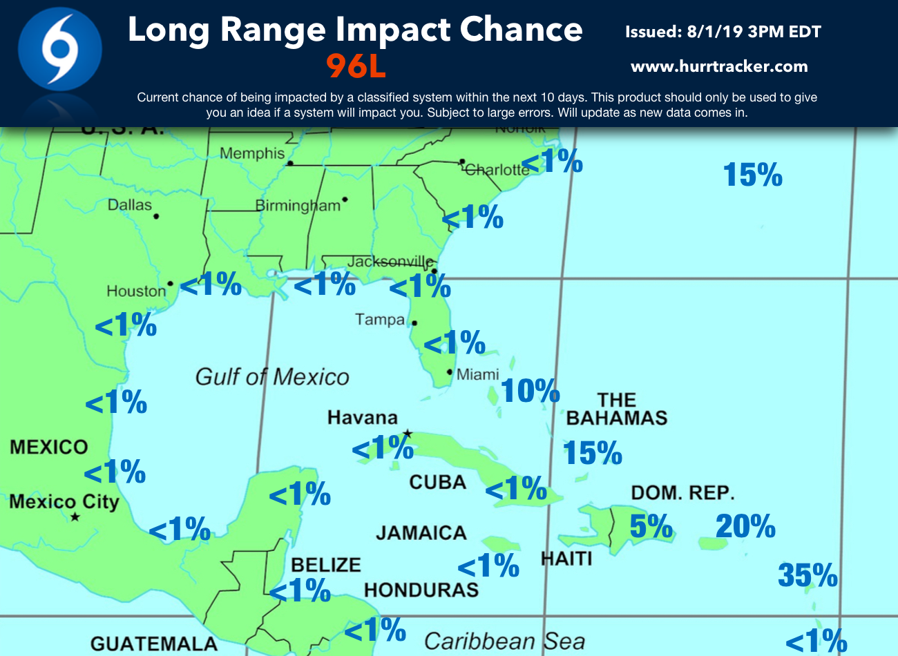
Experimental Long Range Impact Chances (Issued By Our Team).
Hurricane Tracker Alert Levels (Risk of Being Impacted)